Buying Near Mahabalipuram or the ECR: Coastal Zone and DTCP Checks

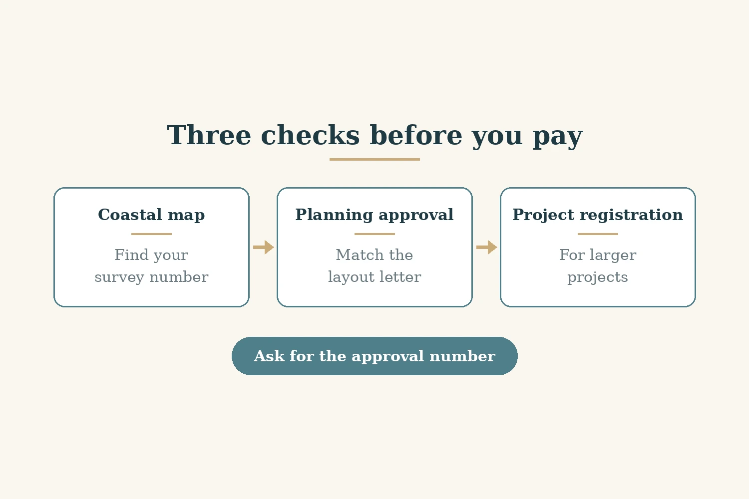
On the Tamil Nadu coast south of Chennai, a plot comes with two maps and a letter, and a seller usually shows you only the first. The land records say who owns the land. The coastal map, drawn under India's Coastal Regulation Zone (CRZ) rules, decides what, if anything, can be built near the sea or a creek. And the layout approval letter from the planning authority decides whether the plot exists as a legal plot at all. Mahabalipuram and the stretch of the East Coast Road (ECR) towards Marakkanam sit where all three checks meet. For a non-resident Indian (NRI) buyer looking at a weekend home or a plot by the sea, phrases such as "outside CRZ" or "DTCP approved" (DTCP is the Directorate of Town and Country Planning) are the seller's words until you have matched them against the official sheet and letter yourself. This guide explains the coastal rules, which planning office may cover your village, and how to check a layout. It makes no claim about prices, rents or future values, and it is not legal advice.
Two maps and a letter: why the patta is not the permission
The patta, chitta and encumbrance certificate (EC) tell you who holds the land and what is registered against it. Our guide to patta, chitta and EC checks in Tamil Nadu covers that side. None of those records says whether a house can be built on the land, or whether the plot sits in an approved layout.
For that, you need two more things. One is the Coastal Zone Management Plan (CZMP) sheet for your survey village, which shows the CRZ category and any No Development Zone (NDZ). The other is the layout approval from the DTCP or the Chennai Metropolitan Development Authority (CMDA), whichever covers the village. A clean patta does not override either. The same pattern runs along India's other coasts; our guide to CRZ land checks in Konkan and Dapoli shows how it works in Maharashtra.
What the CRZ covers on this coast
The current rules are the CRZ Notification 2019, issued by the Ministry of Environment, Forest and Climate Change (MoEFCC) as General Statutory Rules (G.S.R.) 37(E) on 18 January 2019. The Tamil Nadu State Coastal Zone Management Authority (TNSCZMA) hosts a copy of the gazette notification (TNSCZMA, read 5 Nov 2026).
Paragraph 1(i) applies the CRZ to land from the High Tide Line (HTL) to 500 metres landward along the sea front. The HTL is the line up to which the highest water line reaches during the spring tide, as demarcated by the National Centre for Sustainable Coastal Management (NCSCM). Paragraph 1(ii) applies it along tidal water bodies connected to the sea, such as creeks and backwaters, from the HTL to 50 metres or the width of the creek, whichever is less. Its proviso says that until the state's CZMP under the 2019 notification is approved, the limit of 100 metres or the width of the creek, whichever is less, continues to apply (CRZ Notification 2019, read 5 Nov 2026).
That creek rule matters on a coast cut by backwaters. A plot well back from the beach can still fall inside the CRZ if a tidal creek runs nearby. Look for water on the map, not just the sea.
CRZ categories and the No Development Zone
The notification sorts coastal land into four categories (CRZ Notification 2019, read 5 Nov 2026):
- CRZ-I is the environmentally most critical land. CRZ-I A covers ecologically sensitive areas and geomorphological features, and CRZ-I B is the intertidal zone between the low and high tide lines.
- CRZ-II is developed land up to or close to the shoreline within existing municipal limits or other legally designated urban areas.
- CRZ-III is land that is relatively undisturbed, such as rural areas, and not in CRZ-II.
- CRZ-IV is the water area.
Inside CRZ-III, the notification sets an NDZ measured landward from the HTL. Its width depends on the sub-category.
CRZ-III A
Paragraph 2.3.1 designates as CRZ-III A those densely populated CRZ-III areas with a population density of more than 2,161 per square kilometre, on the 2011 census base. There, land up to 50 metres from the HTL is the NDZ, provided the CZMP under the 2019 notification has been approved; failing that, an NDZ of 200 metres continues to apply.
CRZ-III B
Paragraph 2.3.2 designates all other CRZ-III areas, with a population density of less than 2,161 per square kilometre, as CRZ-III B. There, the NDZ stays at 200 metres from the HTL.
So the 50 metre NDZ applies only to CRZ-III A land, and only once the 2019 CZMP has been approved. Until then, the 200 metre line continues. On the difference: 200 metres minus 50 metres is 150 metres, which on a coastal plot can be the whole of it. Paragraph 2.3.3 adds that in CRZ-III, land up to 50 metres from the HTL, or the width of the creek if less, along tidal water bodies is also NDZ. The NDZ does not apply inside notified port limits.
What the NDZ means is set out in paragraph 5.3. In the NDZ of CRZ-III, no new construction is permitted, except the repair or reconstruction of existing authorised structures within their existing floor space index, plinth area and density, and some listed facilities for local communities and fisheries. Beyond the NDZ, dwelling units for local communities with traditional rights are limited to a height of 9 metres with ground plus one floor (CRZ Notification 2019, read 5 Nov 2026). Under paragraph 7, a CRZ clearance is required before permitted or regulated activities start.
Tamil Nadu's coastal map is still the 2011 plan
Paragraph 6(i) of the 2019 notification says that until a state's CZMP under the 2019 notification is approved, the CZMP prepared under the CRZ Notification 2011 continues to be followed for appraisal and CRZ clearance (CRZ Notification 2019, read 5 Nov 2026). So for a plot near Mahabalipuram today, the sheet that counts is the approved 2011 plan, read with the 2019 notification's rules on what continues until the new plan is approved.
The TNSCZMA's approved maps page lists the 2011 CZMP sheets by district and taluk. For Chengalpattu district, it lists Thirukkalukundram taluk on map sheets TN (Tamil Nadu) 99 to TN 103, neighbouring Cheyyur taluk on sheets TN 95 and TN 97 to TN 100, and Chengalpattu taluk on sheets TN 103 to TN 105 (TNSCZMA, read 5 Nov 2026). As for when MoEFCC approved Tamil Nadu's 2011 CZMP, and whether draft maps under the 2019 notification are yet public, we could not confirm this on an official government site as of 5 Nov 2026.
The check itself is simple to describe. Find the sheet that covers your survey village, locate the survey number, and read the CRZ category and the NDZ line from the sheet. Do not rely on a seller's statement that the land is outside the CRZ. This guide gives no CRZ category for any named survey number near Mahabalipuram: we could not confirm this on an official government site as of 5 Nov 2026. Our guide to coastal setback and site plan checks in Bali shows the same idea in another market.
CMDA or DTCP: which planning office covers your village
Layout approvals near Chennai come from one of two planning bodies. Inside the Chennai Metropolitan Planning Area, CMDA is the planning authority; outside it, DTCP or a local planning authority usually is. Government Order (G.O.) Ms. No. 184 of the Housing and Urban Development Department, dated 21 October 2022, is reported to expand the Chennai Metropolitan Planning Area by adding villages in Kancheepuram, Thiruvallur, Chengalpattu and Ranipet districts. We could not confirm this on an official government site as of 5 Nov 2026.
As for whether Mahabalipuram town is inside the expanded area, we could not confirm this on an official government site as of 5 Nov 2026. The practical point is to work from the revenue village of your survey number, not the tourist-town name. Match that village against the G.O.'s list of villages, or ask the planning office directly, and then check the approval with the body that covers it.
Checking the layout approval and the Tamil Nadu Real Estate Regulatory Authority (TNRERA)
Tamil Nadu's online planning permission system is reported to include an approved plan list, searchable by department, approval type, district and year, where the approval letter and approved plan can be opened and matched against the approval number, village, survey numbers and plot number; we could not confirm this on an official government site as of 5 Nov 2026. As for what that portal shows for any specific layout, we could not confirm this on an official government site as of 5 Nov 2026. Ask the seller for the approval number and letter first, and check them against the department's own record before paying anything. A caption saying "DTCP approved" is not the letter.
Ask also whether the local body has released the layout after roads and open spaces were handed over. As for whether the state requires that release, and in what form, we could not confirm this on an official government site as of 5 Nov 2026; treat it as a question to put to the planning office and your lawyer.
The Real Estate (Regulation and Development) Act 2016 (RERA) adds a third check for larger projects. Under section 3(2)(a), registration is not required where the land to be developed does not exceed 500 square metres or the number of apartments does not exceed eight, counting all phases. Above that, under section 3(1), a promoter may not advertise, book or sell without registration (Real Estate Act, Goa RERA official copy, read 5 Nov 2026). TNRERA runs the state's project register; as for what it shows for any project here, we could not confirm this on an official government site as of 5 Nov 2026. Ask for the registration number and search it yourself. Our guide to area measurement across markets helps you read land and plot areas in square metres.
Roads under construction, and what listings show
Two road projects come up in almost every conversation about this coast. The four-laning of the ECR between Mamallapuram and Marakkanam is reported as under construction, and the Chennai Peripheral Ring Road (CPRR) is reported as under construction in sections. Neither status was confirmed on an official site as of 5 Nov 2026, and this guide makes no claim about what either road will do to land values. Treat them as context, not as a reason to buy.
Some ECR listings on avacasa.life describe themselves as DTCP or RERA approved in their own text, while the RERA field on the same records does not show an approval, as listed on avacasa.life on 5 Nov 2026. None shows a CRZ category. Read any approval claim in a listing as the developer's statement, and check the letter, the CZMP sheet and the TNRERA register yourself.
If you are buying from abroad, our guide to what needs you there when buying remotely covers powers of attorney. Our guides to title search in Goa, land conversion in Jaipur, land records in Lepakshi and stamp duty and registration in Telangana show how other states handle the same questions. For the region, see our Chennai guide and Pondicherry guide; for another coast, our Goa guide.
Who this is not for
This is not for buyers of flats in central Chennai, far from the coast and its creeks. It does not cover agricultural land conversion, building plan approval for a house, or tourism licences. It does not say whether any village is in CRZ-III A or III B, or whether any layout is approved; those answers come only from the official sheet and letter. It is not legal advice, and it makes no claim about prices, rents or future values.
Where that leaves you
Near Mahabalipuram and along the ECR, a plot needs three things to line up: the land records, the coastal map and the layout approval. The CRZ covers 500 metres from the HTL on the sea front, and along creeks, 100 metres or the creek width until the 2019 plan is approved. In CRZ-III, the NDZ stays at 200 metres unless the land is CRZ-III A under an approved 2019 plan, and Tamil Nadu still works from its 2011 sheets. Find your survey number on the sheet, find out whether CMDA or DTCP covers your village, match the layout letter, and check TNRERA for larger projects. Only then talk about money.
Sources
- CRZ Notification 2019, gazette copy hosted by the Tamil Nadu State Coastal Zone Management Authority
- Tamil Nadu State Coastal Zone Management Authority: approved CZMP maps
- Real Estate (Regulation and Development) Act 2016, Goa RERA official copy
Ready to find your next holiday home?
Browse our curated collection of vacation homes and managed farmland across India and beyond.