Cliff-Edge Land in Bali: Coastal Setback and Site Plan Checks
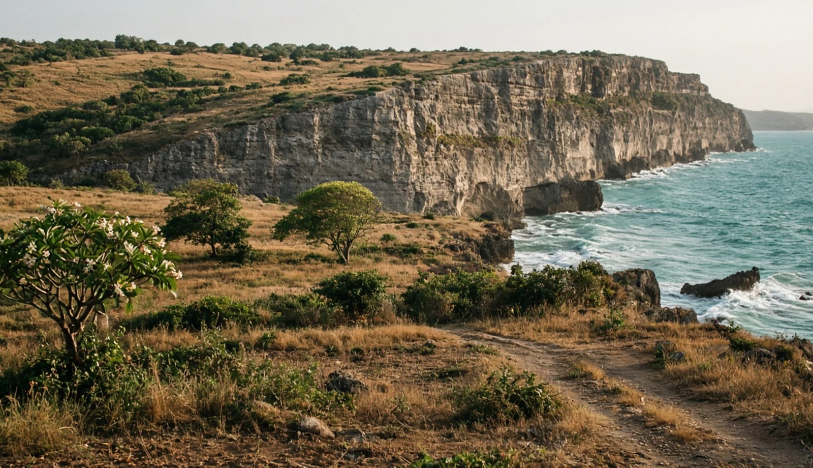
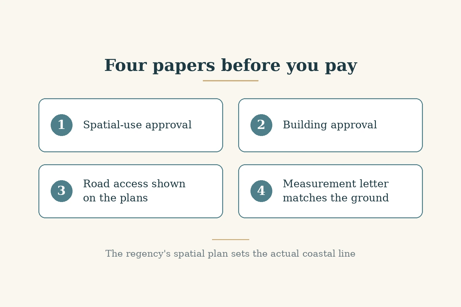
On the Bukit peninsula at Bali's southern tip, the view is what is being sold, and the view sits on the strip of land the law protects most closely. A sales deck may tell you how far the villa stands from the edge, but that number is the seller's, not the regulator's. For a Non-Resident Indian (NRI) buyer, or any buyer who cannot stand on the cliff with a surveyor, the answer is not to trust the distance in a brochure. It is to ask for the papers that show where the protected strip runs, what use the land is approved for, whether the building itself is approved, and whether the plot on paper is the plot on the ground. This guide explains each check in turn and says plainly where we could not confirm something from an official source. Official points were read on 29 October 2026 unless stated. It makes no claim about prices, rents or future values.
What the coastal border means in law
Indonesian law calls the protected coastal strip sempadan pantai. Undang-Undang (UU), meaning law, No. 1 of 2014, which amended the 2007 law on managing coastal areas and small islands, defines it in article 1 point 21 as the land along the shore whose width is proportional to the shape and physical condition of the beach, at least 100 metres inland from the highest tide point (UU 1/2014, Ministry of Finance legal database copy, read 29 October 2026). The law was enacted and promulgated on 15 January 2014.
Peraturan Presiden (Perpres), meaning presidential regulation, No. 51 of 2016 on coastal border lines repeats the same definition in article 1 point 2, including the minimum of 100 metres from the highest tide point (Perpres 51/2016, National Legal Development Agency copy, read 29 October 2026).
The word that matters is "minimum". The 100 metres is a national floor written into a definition. It is not a line drawn on your plot, and it does not tell you where the protected strip ends on a particular stretch of coast. That comes from the local spatial plan, which is the next section.
Who draws the actual line
Perpres 51/2016 article 2 splits the job in two. Under article 2(1), a province with a coastline must set the direction for its coastal border lines in its provincial regional regulation (Peraturan Daerah, or Perda) on the regional spatial plan (Rencana Tata Ruang Wilayah, or RTRW). Under article 2(2), each regency or city with a coastline must set its actual coastal border line in its own Perda on its RTRW. In short, the province sets the direction and the regency sets the line.
The regulation also says how the line is to be worked out. Article 6 requires the calculation to reflect the coast's topography, biophysical and hydro-oceanographic character, and economic and cultural needs, and to provide for protection from earthquakes and tsunamis, from erosion or abrasion, from storms and floods, for coastal ecosystems, for public access and for water and waste channels. Article 7 bases part of the calculation on the level of disaster risk, which is determined by a threat index and a vulnerability index, each grouped as high, medium or low. Article 4 includes, among the purposes of the line, keeping space for public access along the beach.
For Bali, the provincial plan is Perda Bali No. 2 of 2023 on the Bali RTRW for 2023 to 2043, which the provincial spatial planning site publishes (read 29 October 2026). The Bukit falls in Badung regency. We could not confirm Badung's own coastal border line from an official source, so we give no Badung figure, and we could not confirm whether the line on any Bukit beach is wider or narrower than 100 metres. Ask the seller's notary for an extract of the regency spatial plan map covering the parcel.
Cliffs: what we could not confirm
Much of the Bukit coast is cliff rather than beach, and that raises a question the national definition does not answer on its face: how a minimum measured from the highest tide point applies where the land rises sharply above the water. We could not confirm from an official source how the 100 metre minimum applies on cliffs, or whether Bali or Badung sets a separate cliff border. We also could not confirm the cliff provisions of the Bali provincial plan from its official text. So we give no cliff figure. If a seller quotes one, ask in writing which regulation it comes from and get the page.
Check 1: is the use allowed here?
The first paper shows that what you want to do on the land fits the spatial plan. Indonesian rules call this conformity of space-use activity (Kesesuaian Kegiatan Pemanfaatan Ruang, or KKPR). Peraturan Menteri (Permen), ministerial regulation, No. 13 of 2021 of the Minister of Agrarian Affairs and Spatial Planning and head of the National Land Agency (Agraria dan Tata Ruang/Badan Pertanahan Nasional, or ATR/BPN) defines KKPR as conformity between a planned space-use activity and the spatial plan (article 1 point 19). It defines two documents: a confirmation of conformity (KKKPR) where a detailed spatial plan (Rencana Detail Tata Ruang, or RDTR) exists, and an approval of conformity (PKKPR) against other spatial plans (article 1 points 20 and 21) (Permen ATR/BPN 13/2021, legal database copy of the Badan Pemeriksa Keuangan (BPK), the Audit Board of Indonesia, read 29 October 2026).
Under article 5, KKPR for business activity is carried out through the KKKPR or the PKKPR, and through the Online Single Submission (OSS) system, the government's integrated electronic licensing system. Article 7 says the location in an application can be given as a polygon showing the land's area and shape, or, for certified land, as the parcel identification number.
For a buyer, the practical point is to ask for the KKPR document that covers this parcel and this use, and to check that the parcel and the area on it match the land certificate. Our guide to owning property in Indonesia through a foreign-owned company covers the holding structure, and our guide to owning property in Indonesia as a foreigner covers the wider rules.
Check 2: the building approval and the certificate of fitness
The second paper is the building approval. Peraturan Pemerintah (PP), meaning government regulation, No. 16 of 2021 on buildings defines the building approval (Persetujuan Bangunan Gedung, or PBG) as the permit given to a building's owner to build, alter, extend, reduce or maintain a building according to the building technical standards (article 1 point 17). It defines the certificate of functional fitness (Sertifikat Laik Fungsi, or SLF) as the certificate the regional government issues to declare a building fit for use before it can be used (article 1 point 18) (PP 16/2021, OSS copy, read 29 October 2026).
So for a villa under construction, ask for the PBG number on the exact parcel. For a finished villa, ask for the PBG and the SLF. The floors and floor area on the PBG should match what has been built or is being built. A lease is not a building approval. Our guide to how to read project status explains why a status label on a listing is the seller's word rather than proof.
Check 3: the plot on paper against the plot on the ground
The third check is whether the land in the documents is the land you are looking at. Ask for the land certificate and the measurement letter, and compare them on site: the area, the boundaries and the shape should match what is in front of you. If the brochure promises road access, make sure the access you are shown on the ground is the access shown on the plans you are given. Our guides to checking a certificate with Indonesia's land agency, Indonesian land title types and the Bali due diligence checklist cover the land papers in more detail, and our site visit checklist covers what to look at on the ground, whether you go yourself or send someone.
Then lay the papers side by side. For each, here is what should agree:
- Coastal and cliff border: the regency spatial plan extract for the parcel, and a written answer from the seller's notary on whether any part of the plot sits in a protected border. The building footprint should sit outside the protected strip.
- Use: the KKPR for the parcel and the intended use. The parcel, area and use should match the certificate.
- Building: the PBG, and the SLF if the villa is finished. Same parcel, same floors and floor area as built.
- Land: the certificate and the measurement letter. Area and boundaries the same on every paper and on the ground.
- Listing wording: words such as "clifftop" or "beachfront" are marketing until the papers above agree.
Any blank or mismatch is a reason to stop and ask in writing before paying. Our questions before signing a land deal cover the conversation, and our guide to power of attorney for NRI buyers covers acting through someone on the ground.
What we see on our own Bukit listings
As listed on avacasa.life on 29 October 2026, we have 343 listings in Indonesia. Counting only listings in 11 Bukit areas (Bingin, Ungasan, Uluwatu, Nyang Nyang, Nunggalan, Balangan, Pandawa, Padang Padang, Melasti, Dreamland and Pecatu), there are 328. Of those 328, 225 are marked under construction, which is 225 out of 328, or about 69%; 101 are marked completed and 2 ready to move. These are seller labels, not proof of stage. And 121 out of 328, about 37%, describe themselves as cliff, clifftop, beachfront or oceanfront in their listing text, but none of our records for them carries a KKPR, PBG or setback reference. That is the gap this guide asks you to close yourself.
Our guide to how Indians buy property in Bali covers the buying route, and our guide to repatriation and Indian tax on Bali property covers the money side. Our Bali guide, Uluwatu guide, Bingin guide, Ungasan guide and Indonesia guide describe the places.
Who this is not for
This is not a guide to whether a Bukit villa is a good purchase, or to prices, rents or future values; we make no such claims. It does not give a setback figure for Badung or for cliffs, because we could not confirm one from an official source. It does not cover which ownership structure suits you, how the land agency's online services work, or structures that reach into the sea. And it is not legal advice: for a specific purchase, an Indonesian notary and lawyer should read the documents.
Where that leaves you
On the Bukit, the closer a villa is to the edge, the more the papers matter. National law sets a minimum coastal border of 100 metres from the highest tide point, but the actual line comes from the regency's spatial plan, and we could not confirm how it applies on cliffs. So ask for the spatial plan extract, the KKPR, the PBG and, for a finished villa, the SLF, and compare the certificate and measurement letter with what is on the ground. If all of them agree, you have a basis to proceed. If any is missing or disagrees, stop before any money moves.
Sources
- Ministry of Finance legal database: UU No. 1 of 2014 amending UU No. 27 of 2007 on coastal areas and small islands
- National Legal Development Agency: Perpres No. 51 of 2016 on coastal border lines
- Bali provincial spatial planning: Perda Bali No. 2 of 2023 on the Bali RTRW 2023 to 2043
- Badan Pemeriksa Keuangan (BPK), the Audit Board of Indonesia, legal database: Peraturan Menteri (Permen), ministerial regulation, ATR/BPN No. 13 of 2021
- OSS: PP No. 16 of 2021 on buildings
Ready to find your next holiday home?
Browse our curated collection of vacation homes and managed farmland across India and beyond.